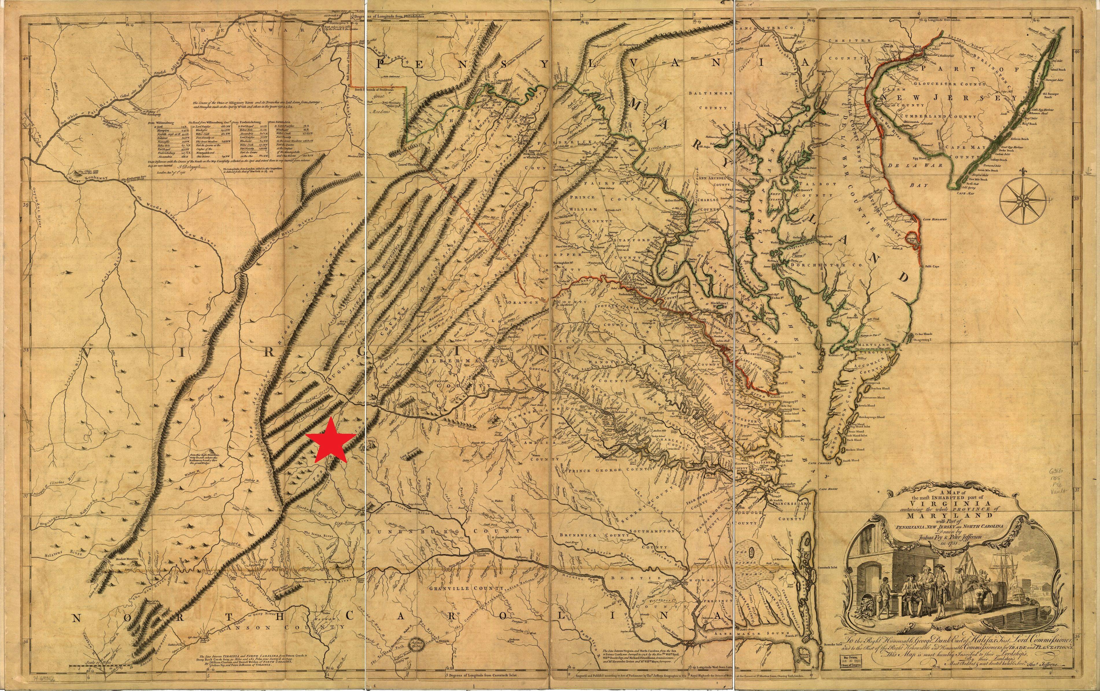
Jack - “A Map of the Most Inhabited Part of Virginia”
Jack arrived in Virginia from his previous enslavement in North Carolina, his owner brought him to Botetourt County. As shown on this 1755 map, Botetourt County (marked with a star) was located along the western frontier—a mountainous region isolated from the more populated east. Jack was likely his owner’s only enslaved person. His duties probably included a little of everything: farming, clearing land, preparing firewood, mending tools, taking care of animals, repairing the house, and other tasks. In contrast, the majority of enslaved people in eastern Virginia lived on farms or plantations with at least ten other enslaved people. This meant they typically had a more specialized work assignment, as well as a built-in community.
Geography and Map Division, Library of Congress, Washington, DC