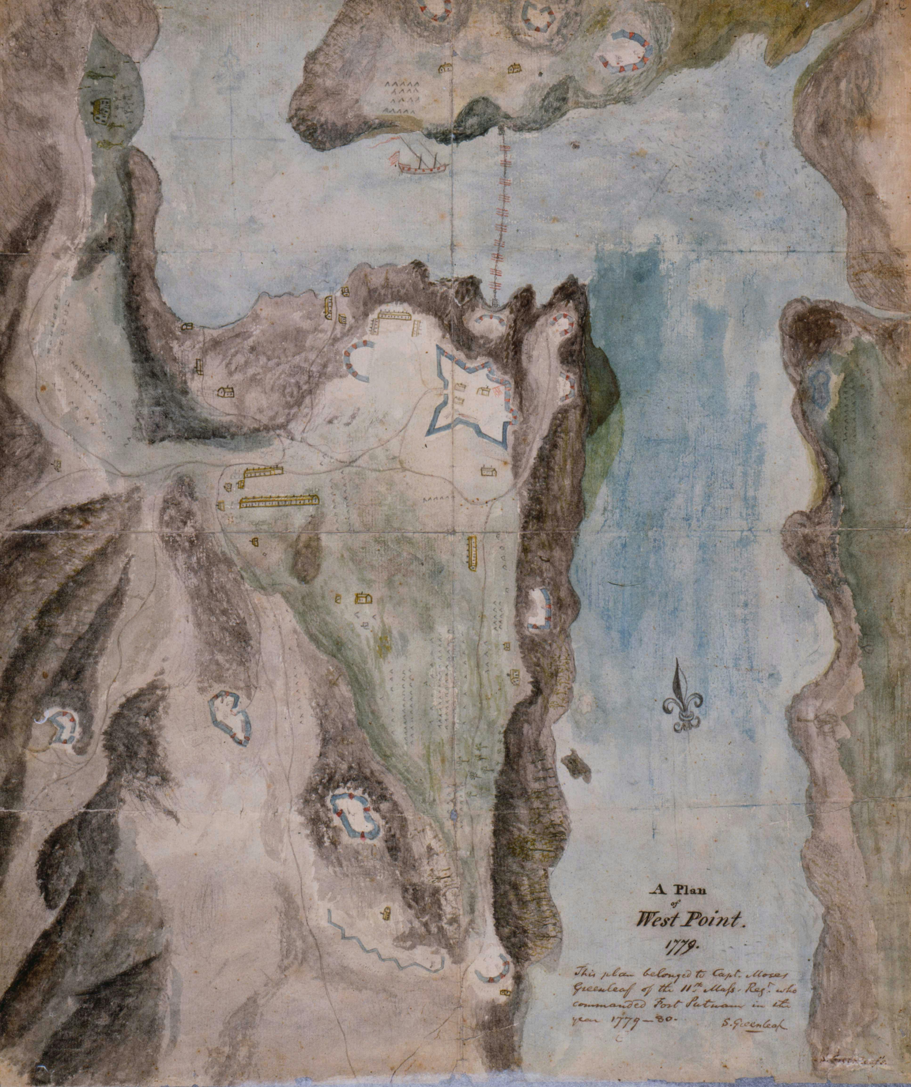
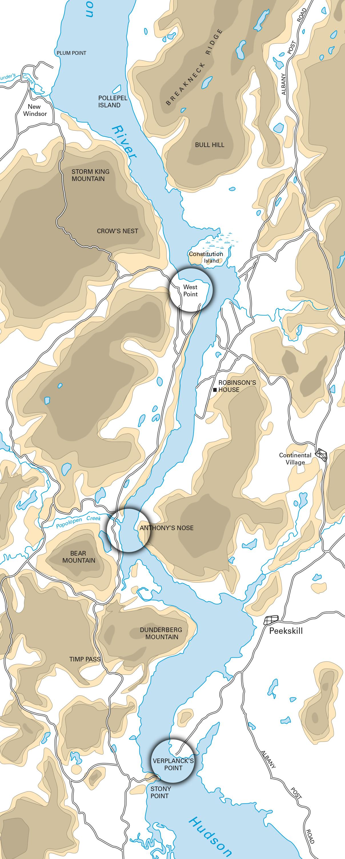
During the Revolutionary War, Americans clustered their Hudson River fortifications around three narrows– West Point in the North, Fort Clinton and Fort Montgomery at the Popolopen Creek in the middle, and Stony Point and Verplanck’s Point at King’s Ferry to the South. These posts were between 45 and 60 miles from New York City. West Point was the Continental Army’s strongest fortification. Verplanck’s Point and Stony Point, on either side of King’s Ferry, were the front line against the British to the south.
Hudson Highlands, 1780
Courtesy of the United States Military Academy Department of History